Understanding City Growth
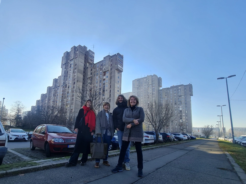
The accelerated growth of the city caused by a large population influx as a result of political and social changes in the last thirty years has led to major changes in the urban fabric of Belgrade. Citizens of the capital city often talk about the threatened identity of the city, problems in functioning, inadequate infrastructure, pollution. In contrast, there are unquestionable qualities, 7000 years of uninterrupted urban history, the position at the confluence of two large navigable rivers, the overlap of numerous cultural influences, but also countless demolitions and rebuilding as a consequence of life on the limes, turbulent history and war destruction that repeats itself every 40 -50 years. The urban identity of Belgrade is formed by buildings, objects and interspaces created in all historical periods. Cultivating the spirit of a place means recognizing and marking significant memory and material layers of the city.
What today makes Belgrade recognizable on the urban map of Europe is precisely the material testimony of a long continuity of existence through fragments of preserved traces and with the culmination of the inter-war and post-war period of modernism. We invited LINA fellows, young emerging creatives, to Belgrade to give an insight into the development potential of Belgrade from their perspective through various media. This year, the focus is on New Belgrade, more precisely the Bežanija settlement/village and opposed brutalist mega structure of Bežanije blocks 61, 62 and 63. This border territory in permanent transformation, at the meeting point of the rural environment and the structure of mega blocks, is a great challenge for urban planners and architects. The first part of the Understanding City Growth, as part of the 2024 LINA Architecture Programme, the residency period, was dedicated to the research, meetings and workshops. During their stay, LINA fellows, in addition to the opportunity to get to know each other and exchange experiences, achieved cooperation with representatives of various institutions and organizations, local residents and representatives of different generations. The later period, upon their return, was dedicated to analyzing and defining the proposal. The last one was the joint exhibition “Understanding City Growth” during the BINA 2024 festival, organized in the BINA pavilion. For the occasion of the exhibition all fellows gathered again in Belgrade to present their proposals that would contribute to improving the situation and quality of life in the neighborhood, preserving the identity of the place and transformations in accordance with the requirements of modern life and the needs of the residents.
Having in front of us the results of the work of all six LINA fellows teams, it can be concluded that by applying different methodologies, in a certain sense, they all came to similar conclusions. The first obvious fact is that even after almost half a century since the construction of the new housing blocks, there is a clear division between the old rural matrix of the village of Bežanija and these structures of Blocks 61-64. These very different, but very close residential areas largely function separately and without insight into the history of some and the specifics of others. The second conclusion is that since the creation of urban plans relating to the entire territory and since the construction of blocks, there have been significant changes in political and social system, lifestyle and standards and that it is necessary to rethink the situation on the ground and make certain changes that would contribute to the quality of life of citizens.The identity and order of the old matrix of the Vojvodina settlement Bežanija, as the oldest settlement on the territory of New Belgrade, is threatened, and the memory of the place is also suppressed. However, within the settlement itself there are oases of common life and self-organization of residents who are fighting for the survival of their community. It is precisely these values, in the opinion of LINA fellows, that should be preserved and for the purpose of which the community should be strengthened and support provided by the system, through local authorities and institutions for the protection of monuments, culture and education.
On the other hand, when analyzing the blocks created in the period of the 70s of the last century, and which are still being extended, LINA fellows conclude that despite the former planned construction, the passage of time, changes in lifestyle, but also often insufficient maintenance or inadequate use of space, clearly indicates the need to first of all rethink and adapt public spaces to new conditions, habits, but also to global phenomena such as climate change, which dictate different needs of residents. When studying the assigned territory, LINA fellows also recognize positive models of appropriation and spontaneous use of public space by citizens such as spaces for gathering and socializing, bocce ball court, etc.
All these insights, created during a short residential stay, once again confirm how useful exactly this kind of transdisciplinary analysis, contact with the local community and citizens are, as a preparation for further planning and corrections in order to improve the current situation on the ground. A discussion with local urban planners organized during the opening of the exhibition: Božana Lukić (Ministry of Construction, Transport and Infrastructure), Žaklina Gligorijević (Society of Female Architects) and Ana Graovac (New Planning Practice) confirmed this position and indicated the need for precisely this type of analysis and preliminary work that would largely contributed to the quality of urban plans but for which there is often no will due to financial, but also circumstances dictated by the market, investors demands and politics.
Collaboration with LINA fellows
>> Giulio Galasso (Italy)
Boulevard-s. A vision for Blocks 61-64
The wide boulevard that runs through the heart of Blocks 61-64 is burning during summer. Originally designed during the socialist era in Yugoslavia, this grand residential scheme was distinguished by its extensive outdoor areas, with each linear residential building enjoying access to both an adjacent linear courtyard and the communal boulevard. Although the residential buildings were completed as planned, a proposed linear community center along the boulevard never materialized, resulting in a neighborhood with a predominantly residential character.
Following the end of socialism, the boulevard saw a disorderly emergence of commercial ventures, including shopping malls, restaurants, and gambling houses, which occupied public land without adherence to a unified master plan. This period of deregulated growth also saw a significant increase in vehicle ownership among residents, leading to the conversion of large sections of the boulevard into parking spaces – which despite their abundance are still always full.
This unchecked expansion, although improving the residents' comfort and decreasing their dependency on the city center, has led to several negative consequences: extensive surfaces have been asphalted, exacerbating the overheating problem during the summer months, and many grassy spaces have been neglected due to the challenges associated with managing such large areas. As a result, a substantial portion of the outdoor area has become underutilized by the community.
This team introduce a vision to reconfigure the boulevard and its surrounding spaces to mitigate these challenges, enhancing their usability during the hottest months and allowing for the densification of services. Central to this plan is the redesign of the outdoor environment to feature several boulevards running parallel to the linear residential units, instead of a solitary, extensive boulevard in the middle. Commercial and parking facilities will be strategically repositioned along these new boulevards, scaling down the outdoor areas to a more relatable dimension and revitalizing areas that are currently underused.
The new parallel boulevards will serve as green arteries linking the Bežanija Forest with the River Sava, interspersed with trees and buildings that provide ample shade, thereby serving as reservoirs of cool air in summer. This approach will not only improve the microclimate but also render public spaces more inviting and compelling for the inhabitants, spurring them to actively participate in their maintenance. Similarly, commercial entities situated along the new boulevards will be encouraged to care for the neighboring outdoor zones, promoting a unified commitment to the stewardship of these spaces.
In addition to participating in the LINA program, Giulio Galasso and Natalia Voroshilova also participated in the central program format of BINA 2024 under the title "Echoes of Modernism". They gave a lecture "Grand- Ensemble-Dörfli/Garden City Neighborhoods in Zurich 1943-57" about the garden cities that were built by cooperatives in Zurich in the 1940s and 1950s, and are hybrids of the modernist Siedlungen style and the local typology houses: a naive response to the social and technological transformation that was taking place in Europe. This lecture, within the framework of the exhibition "Vila Prendić - new view, new duration", provided an insight and enabled a comparison of the two versions of the urban concept of the garden city created in the period 1926-1941. in Belgrade and a little bit later in Zurich.
>> Alberto Roncelli & Nicole Vettore (Denmark/Italy)
Decoding the Void: Anatomy of Urban Residualities in New Belgrade Blocks 61, 62 & 63
The project Decoding the Void: Anatomy of Urban Residualities explores the meaning of urban residualities in the context of New Belgrade and tries to build a deeper understanding of the opportunities and qualities of public space in modernist blocks. If residual spaces (or urban leftovers) are a common by-product of city growth, that emerge from the constant juxtaposition of different programmes and typologies and the never-ending transformation of places, when approaching New Belgrade Block 61, 62, 63 defining residual spaces seems to acquire a certain level of ambiguity, and, in a way, not to be possible at all.
Residuals usually results from unintentionally planned urban reality, unregulated growth, infrastructural over imposition and a lack of integration between functions. According to Solà-Morales’s definition of Terrain Vague (1995), these spaces are “outside the city’s effective circuits and productive structures” and are elements without specificity that provoke unfamiliarity and confusion to those who encounter them. Although none of these conditions are present in the 1 square kilometer area designed by Darko Marušić, Milenija Marušić and Milan Miodragović on Svoboda's urban plan (1965), a number of elements fail to actively participate in the life of the city and appear as uncared and neglected parts of public space. Contrary to traditional residuals, these spaces are not the spatial products of unplanned conditions, but they emerge from well-planned spaces designed to fulfil a specific purpose and be part of a coherent urban settlement.
Today, the area has lost approximately 38 000 square meters of green space (-43%) and has undergone a densification of 72 000 square meters of new building footprints (+31%). Half of the agricultural village of Bežanija has been demolished and the rest seems to be segregated, awaiting an uncertain fate. It is therefore necessary to understand the reasons for the generation of these spaces, their qualities and strengths, and whether they can represent an opportunity for future urban implementations, supporting processes of densification or acting as key elements of new ecosystems of care.
What kinds of spatial residualities have been produced by the New Belgrade’s Block 61, 62, 63? How do the locals interact with these residualities? How is the ownership of these spaces perceived? What has prevented them from flourishing? How do they vary between the blocks and the village of Bežanija? “Understanding uncared, underused, and abandoned portion of public space is a crucial factor to establish and test new processes of regeneration. Discussing their ambiguous perception, their qualities, and their impact inevitably gives us a new perspective on the city. We hope the project can be helpful for opening up healthy discussions for the future of Blocks 61, 62 & 63, but also to be relevant to the wider New Belgrade and other post-war modernist areas with similar conditions.” (Excerpt from the text in 19. BINA catalog by Alberto
Roncelli)
Decoding the Void: Anatomy of urban residualities is presented in three parts:
Part I: A Catalogue of Neglected Spaces (Mapping)
Over 300 residual areas within Blocks 61, 62 & 63 have been identified, analyzed, and categorized. These areas collectively cover approximately 30,000 square meters, constituting around 5% of the total site area. Qualitative and quantitative aspects have been examined and compiled into a detailed catalogue. The "Grafted City Project" mapping methodology, consisting of field mapping, photo registration, interviews and GIS mapping was used and expanded.
Part II: Oversized, Undersized, Fit (Understanding)
Efforts have been made to comprehend the reasons behind the neglect of these spaces, with a focus on investigating the relationships among infrastructure, buildings, open areas and residuals. Quantities have been contextualized to understand their potential impact on the site.
Part III: Prototypes (Visioning)
This section presents the potential redefinition of open spaces starting from the exploitation of the urban residuals. A series of prototypes, and design tools are proposed and explored. The Block 62 was used as a 'pilot
Block'.
>> Maria Mendez (Spain)
Walking and Drawing Bežanija Village. Creating alternative images for the periphery of the city.
Bežanija Village is the oldest settlement still standing in New Belgrade. Its characteristic pitched-roof housing typology and urban structure edged by vineyards is today found cornered between the plateau and the high concrete residential towers of the brutalist era. Bežanija Village is unique; it holds landscape, heritage, and social value that deserves to be preserved amidst the rapid urban development: so much so that there is already a local citizen association in charge of keeping alive the memory of Old Bežanija.
“When BINA proposed me to work in this area of the city, I was surprised to hear that it was under threat: my perception when visiting it was that not only that it has, like many historical places, a unique charm and significance and a peaceful atmosphere: it also generates an interesting contrast and remarkable variety in the urban landscape coexisting with the brutalist towers, very different in scale and in proportions. In a time where all cities are becoming more and more alike, I am convinced of the value and importance of working for its preservation amidst the rapid urban development.In my practice, I seek to explore peripheral or contested spaces using subjective and experiential practices like drawing and walking. My research aims for a sensitive and immersive approach to studying and engaging with these peripheral areas, challenging conventional perspectives. The focus is on paying attention to the places as they are and giving voice to their unique identities and stories, questioning the predefined narratives that have been created elsewhere.” (Excerpt from the text in 19. BINA catalog by Maria Mendez)
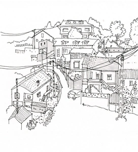
In the framework of her workshops in which she included a large number of participants: school-aged children, students and local residents, Maria Mendez applied a specific methodology: drawing and walking. Participants established an intimate connection with the environment, capturing their subjective experiences through artistic expression. Participants established an intimate connection with the environment, capturing their subjective experiences through artistic expression, and doing it collectively enabled them to share their insights and deepen their way of looking through the perspectives of others. By fostering a deeper connection with the space, it contributed to the ability of participants to be aware of the necessity and advocate for more responsive and empathetic urban practices that respect the realities and needs of peripheral territories and communities like this one.
“Lastly, all of this leads us to reflect on what images and iconography are used to showcase our territories and with what objectives (solely touristic or economic? how does it affect at a local level?), in what contexts (only in the city center? only for tourists?), and by whom they are chosen and produced. How can we take ownership of the images that are shared of the places we inhabit? Can the practice of drawing be useful for making these images closer to our daily experience of the territory, more our own? Building upon these questions, the project outcome will work with the language of the touristic object (souvenir): postcards, t-shirts, tote-bags… Based on the drawings made in the collective encounters, an alternative version of these elements (our own merchandising!) will be made for Bežanija Village, in order to restore its value in a symbolic way to its inhabitants and the rest of the city.” (Excerpt from the text in 19. BINA
catalog by Maria Mendez)
>> Nevena Delić
Toolkit for urban exploration
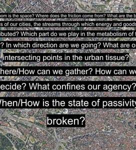
“Toolkit for urban exploration” is a project that looks into the preoccupations and forms of resistance that can be found in the urban tissue of New Belgrade, specifically the area of Bežanijska kosa. Consisting of four scores - a series of participatory and task-based activities, the project unfolds in specific locations that are able to put on display the issue that is being addressed. The project as a whole aims to tackle phenomena such as the tension between the former socialist model city and the new socio-political order, the pressures of commodification, to provide insight into the history of the landscape, as well as to rethink what role vacant and neglected spaces can play in the context of growing peripheries. Public space has always been a precondition for public life, manifestations of collectivity, as well as a stage for negotiating interests, a contested space where frictions appear and where antagonism is the driving force for
change. Looking at New Belgrade, it is easy to perceive the urban struggle and resistance that have culminated over the past years. In a city driven by foreign investors and private capital, there is very little room left for community and free use of public spaces. The green areas are disappearing under the pressure of neo-liberal principles, privatization and profit-driven policies. They are turning into spaces of consumption, to both satisfy and create the needs of a consumer society. On the other hand, certain in-between spaces that are situated within the blocks are showing resistance, they somewhat represent failed utopias, neither serving their original purpose nor adapting to the new socio-political order. They are withstanding commodification, but gradually decaying as neglected areas that don’t have a particularly defined scope. They are in-between, both physically and symbolically. The guides and scores aim to achieve just that: activate these spaces as stages for reflection, non-productive activity and materialize the right for such use of public spaces, as well as question the passivity we have towards the open spaces we inhabit. They will focus on a particular area, but can be applied to any urban context that displays similar currents and preoccupations, they are reproducible and open for interventions. The scores will therefore explore the potential of the undefined, the agency that we have in relation to actively creating and using public space, as well as the pleasure in temporarily reclaiming it and wasting time while doing so.
HANDBOOK 1: Scores 1 and 2
Location: “Livadica”, Marka Čelebonovića 33, 44°49'08.2"N 20°22'43.8"E
Score 1 aims to reflect on one of the most evident examples of urban struggle - the tension between the former socialist model city that intentionally planned and preserved spaces as infrastructure for community and common good, and the new socio-political order that is taking them away. The idea is to occupy oneself with a seemingly banal task of inscribing in space using chalk in order to provide time for necessary reflection.
Score 2 examines the history of the territory you are overlooking, the transformations that took place and allowed for New Belgrade to expand, retracing the horizon that is now obstructed by the built environment. It provides insight into the history of the landscape and its cultural significance, the displacements and alienation that took place within it.
HANDBOOK 2: Score 3
Location: “Filipov park” in Ljubinke Bobić street, 44°81'44.3"N 20°37'26.1"E
Score 3 questions how and to which degree undefined public spaces can accommodate social interaction, and if so, interaction of which kind. The image associated with the word neighborhood is vague, usually stems not from one’s own recollection, but from the generally wide-spread idea of what a neighborhood should be. The surfaces between multiple-story buildings are peculiar in the sense that they are intimate and public at the same time; they are open, yet clearly establish the border between inside and outside; they belong to everyone and no-one, functional and dysfunctional. If all spaces are produced by social relations, as Lefebvre states, the ones in-between buildings most certainly are. With a vague definition and hardly no recognizable common traits, these not-quite parks, not-quite playgrounds and not-quite parking lots can take up different shapes and roles. They bind together, allow interaction and the frequency of interaction that constitutes a neighborhood rather than just a place of cohabitation community born out of inevitability and proximity, becoming both a context and a certain type of commodity, something of service to rely on.
HANDBOOK 3: Score 4
Score 4 looks into the vacant spaces of the city resulting from rapid development and negligence and further examines their potential and the role they play in a transforming landscape. It is based on the notion of theThird Landscape, coined by Gilles Clément, which refers to abandoned territories, spaces that are byproducts of the anthropization of the earth, occurring at the peripheries of a city. According to Clément, all spatial organization generates neglected space. In the context of cities, the most common example is land awaiting allocation or implementation of projects, left undecided and undefined due to provisional political decisions.
The Third Landscape is considered an oversight, a space of unproductivity and indecisiveness, guided by the principle of not doing, an opposition to organized territory; it therefore acquires a political dimension. Clément argues for the moral, political and social deregulation of the Third Landscape, for seeing them as privileged spaces and recognizing their ability to constantly reinvent themselves.
>> Isidora Koščica, Jana Čvertkov and Lana Jeremić
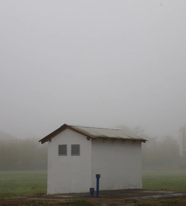
Informal Documents: A series of reflective photographs
Urban spaces are in the state of eternal expansion. In their nature, they are developing, as they suppress and force other environments to retreat. Yet within their own structure, cities are also prone to changes, reflecting the state of the society and spirit of the age with these transformations. If we consider these changes from a distance, we shall see the geopolitical, or historical context (of the creation and growth) of a city. But what happens if we endeavour to seek changes in details? If for a moment we accept the metaphor of a city as a theatrical stage for everyday narratives, we may understand man as the protagonist. Though evidently hidden behind the scenery, man integrates into and interacts with urban space, adapting and shaping it. Human impact inevitably peeks out of the city structures. The project titled Informal Documents tries to research this phenomenon and provide insight into the daily existence of a city through its metamorphoses and micro-changes. By studying these questions, we take the role of a collector, explorer and storyteller of a first-person narrative, as we record the complexities of urban reality.
In its form, the project is an attempt at mapping the neighbourhood of Bežanija, i.e. blocks 61, 62, 63 and 64 and Old Bežanija (Bežanija Village), while the methodology comes down to a series of walks, the result of which is a series of reflective photographs/spatial notes. Due to its history marked with transformations, the space of Bežanija represents a picturesque example of the urbanisation process and its consequences. The modernist architecture of the blocks clashing with that of Old Bežanija leaves the impression of a dichotomy, but simultaneously opens up the question of their similarity. By recording the routes of these unplanned walks through Bežanija, our interaction with the space becomes visible and documented. Through this approach, by exploring and drawing new, informal borders, we map a different Bežanija, shaped through human agency.
By using the media that are in their essence documentary and artistic, the project exists on the edge between art installation and archive. In this sense, the photographs and maps keep their dual function. On the one hand, they are the documents of the research process, while on the other, they represent attempts to catch and record the ephemerality of the city: the city as is now, as a reflection of the society, which tomorrow will have undergone some other transformation already. In spite of this transformative force of the city (or even being influenced by this very force), Informal Documents are an attempt to fix an urban portrait, with all its specific traits, permutations and the influences that shape it.
>> Sara Ramezani
Documenting Public Spaces in the Bežanija Blocks
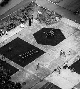
This project is dedicated to using the power of photography as a means to document life within three blocks in New Belgrade (blocks 61,62 and 63), showing the complex relationship between public space and its users. Based on plans and designs from the early 1970s, these blocks were precisely planned, where careful consideration was given to the intermediary spaces between them. By comparing the original plans and designs with how public spaces are being used today, differences become apparent in their functionality and community utilization.
The photographic collection is organized into three categories, each offering different insights. The first category focuses on public spaces intentionally designed for specific activities, such as shopping or social interaction. Through captured images, viewers can understand how people engage with these spaces as intended by their original design.
The second category delves into the spaces initially designated for public use but now serving a different purpose. These areas, often small open spaces between the buildings or corridors connecting the blocks, have been observed to be neglected or underutilized, diverging from their intended role as communal gathering spots. This disparity is depicted through photographs, showing the lack of adaptation of urban spaces meant for communal gathering, or public spaces being used in a completely different manner.
Finally, the third category explores spaces not originally conceived as public areas, yet which have undergone unforeseen transformations over time. These transitional spaces, such as makeshift pathways through the greenery, improvised gathering spots, or even the ever-growing parking area, offer valuable insights into the organic or semi-organic evolution of urban environments and the fact that just as much as space shapes people’s lives and behavior, people also affect and shape the space to adjust it to their needs.
Besides that, photographs provide an overall insight into how the space between the buildings is being used, who are the main users and how it’s been maintained. Also, it provides a slight evaluation of urban design qualities such as livability, sense of belonging, safety, sense of security, human scale, greenery, and so on.
By showcasing the life within these public spaces, the photographic collection provides a window into the dynamic interaction between urban design and the evolving lifestyles of inhabitants, highlighting the flexibility and ingenuity characteristic of urban communities.The Realization of the LINA/BINA Project “Understanding City Growth” was supported by the citizens' association "Stara Bežanija", Elementary school "Jovan Sterija Popović", Language school "Junior", Cultural Center of Belgrade, Faculty of Architecture, Faculty of Fine Arts, Belgrade, PUC Greenery Belgrade, Institute of Architecture and Urban & Spatial Planning of Serbia
Related fellows
